TRAINMASTER
BY WERNER MEER US-RAILROAD-SHOP KILCHBERG HOCHWEIDSTRASSE 3 CH-8802 KILCHBERG (ZÜRICH) SWITZERLAND (founded 1977) PHONE *41-44-715-3666, FAX *41-44-715-3660, E-MAIL trainmaster@bluewin.ch Go back to our Website - click here |
Cajon Pass 2010 - Page 8/9
Cajon Pass Photo
Collection May 28/29/30 & June 4/5, 2010 |
by Werner Meer |
Updated: April 30, 2011
Mormon Rocks - Highway 138 |
This
time, Melinda (my wife) came also along and she sure enjoyed this trip,
doing a lot of railfanning. We also met Beat & Christa Wuest (Switzerland)
and we had 2 fantastic days in exploring Cajon Pass from Summit to
Silverwood, Hill 582, Alray, Mormon Rocks, Sullivan's Curve down to
Swarthout Canyon Road and old Route 66 (Cajon Blvd). Here, we show photos of the Mormon Rocks Pine Lodge Area incl. Highway 138. List of photographers: Beat & Christa Wuest, Werner & Melinda Meer (Switzerland). Guest photographers: Gary G. Gray, (USA). A big thank you for sharing these excellent pictures with us. Note: The copyright belongs to these people. Do not use any photos without written permission. Abbreviations found on this page: EB = East Bound, NB = North Bound, SB = South Bound, WB = West Bound, MT-1 = BNSF Main 1, MT-2 = BNSF MAin 2, MT-3 = BNSF Main 3, UPT = Union Pacific Track, MP = Mile Post, DBS = Double Stack Train, TOFC = Trailer on Flat Car, DDR = Davis Ranch Road, WSI = West Summit Island |
For bigger size photos - please click on the 4-digit number below each photo. Not every photo has a comment/caption.
To
get a better idea about these locations you can find 6 aerial photos (wich
I took during this trip). At the bottom of this page is a map with captions. More aerial photos of Cajon can be seen here: click here |
||
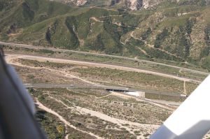
Overview Mormon Rock Area - 4038 | Looking West: Hwy 138 in the middle - 4040 | Highway 138 bridge over BNSF MT-3 - 4041 |
BNSF MT-1 and MT-2 w/Cajon Creek bridge - 4074 | Looking North: UPT, BNSF MT-1 & 2, MT-3 - 4072 | BNSF MT-3 and I-15 (Steins Hill) - 4075 |
Part 1 - Friday, May 28, 2010
On Friday, May 28, 2010, we were coming from Barstow in the late afternoon (on the way to San Bernardino), we quickly got off Interstate 15 at Highway 138 exit. Here is the Pine Lodge - Mormon Rocks Area. From Highway 138, we do have good access to BNSF MT-1, MT-2, MT-3 and the UPT as well. | ||
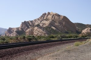
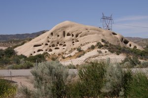
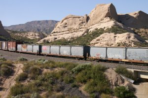
Cajon Pass' famed "Mormon Rocks" are a series of cemented sandstone beds much more resistant to erosion than the surrounding gravel and silt sands, giving them a pockmarked appearance. Officially called the Rock Candy Mountains, the strange rock formations are one of the youngest and most active geological regions in North America. Formed by the overlapping of the Baja Plate and the North American Plate, the Mormon Rocks (so nicknamed because this was the preferred route of Amasa Lymand and Charles Rich, who led a band of Mormon settlers from Salt Lake City across the Mojave Desert in 1851) are a visible indicator of the San Andreas Fault (where the two aforementioned tectonic plates collide). Written by Craig Walker, Nov 13, 2010 | ||
BNSF MT-1 and MT-2 under Hwy 138 - 1208 | BNSF MT-2 is the new 3rd MT - 1209 | photos of the 3rd MT construction: click here - 1210 |
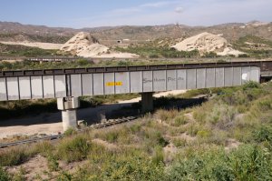
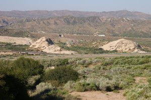
Sandstone Rock formations between BNSF - 1211 | Mormon Rocks w/UPT in the middle - 1213 | Ex. SP bridge (now UP) over Hwy 138 - 1214 |
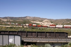
Our first train is a BNSF WB on MT-2 downhill from Davis Ranch Road (as we can see in the distance on 1192 and 1193). Yes, I am aware, the sun is not on our side but there was really no time because we already saw this train when we came down the freeway just before the exit to Hwy 138. We were actually just rolling over the locos of this BNSF WB train. So, big rush to catch it before it was gone. | ||
BNSF WB coming from DRR - 1192 | first loco passes MP 61.4 X - 1193 | Rolling over Cajon Creek bridge - 1194 |
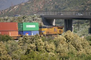
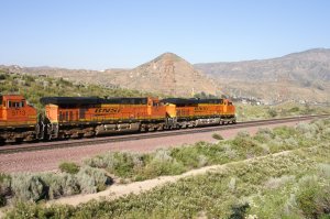
BNSF 7383 = GE ES44DC built 2010 - 1195 | 2nd unit 7858 = GE ES44DC built 2010 - 1196 | Rolling under Highway 138 bridge - 1197 |
the famous Mormon Rocks . . . - 1198 | . . . are always a great background . . . - 1199 | . . . for any train . . . - 1200 |
. . . and on top, easy to reach - 1201 | this bridge was wide enough for the 3rd MT - 1202 | the pavement is a leftover of old Hwy 138 - 1203 |
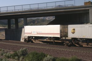
many intermodal trains are combined . . . - 1204 | . . . double stack container's and TOFC's - 1205 | end of BNSF WB train - 1206 |
On photo 1207 we can see the end of the BNSF WB train (I am standing on the other side of Hwy 138). Photo 1215 shows Highway 138 overpass (over BNSF MT-1 and MT-2) and photo 1207 was taken from the retaining wall on the right side. Now, I am standing above the UPT and on photo 1216 we can see a UP NB coming thru the cut in the distance. And finally, we made it to the sunny side of the tracks! Let me quickly explain one more thing. As we all know, a train does not only exist of the locos but actually of all the freight cars, I am always taking plenty photos to show several positions of the train and the different cars. Well, it is almost like a movie with still pictures. Therefore, this UP NB is having 37 photos ! ! | ||
the WB is already rolling thru Sullivans Curve - 1207 | Highway 138 is our "service road" - 1215 | UP NB on UPT coming thru the cut - 1216 |
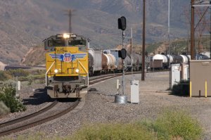
4 locos are pulling a mixed freight - 1217 | 1218 | here is the switch of the UP siding - 1219 |
1220 | 1221 | 1222 |
1223 | UP 7676 = GE C45ACCTE built 2007 - 1224 | bridge built by SP back in 1967 - 1225 |
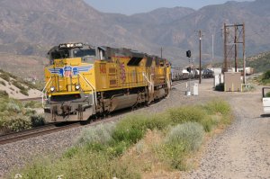
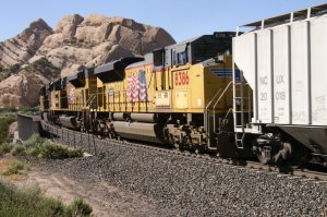
2nd unit 7664 = GE C45ACCTE built 2007 - 1226 | 3rd unit 4660 = EMD SD70M built 2001 - 1227 | 4th unit 4288 = EMD SD70M built 2001 - 1228 |
1229 | 1230 | 1231 |
1232 | waste containers - 1233 | 1234 |
1235 | 1236 | 1237 |
1238 | 1239 | 1240 |
1241 | 1242 | 1243 |
1244 | 1245 | Hwy 138 can been seen thru empty car - 1246 |
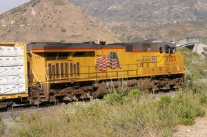
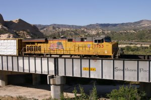
1247 | 1248 | DPU UP 7753 = GE C45ACCTE built 2007 - 1249 |
1250 | 1251 | end of UP NB train - 1252 |
Before leaving this location and going to the Motel, we got a BNSF WB on MT-2 and a UP EB on MT-1. We are still standing just above the UPT near Highway 138. Once again, there was no time to get closer to the BNSF tracks because this BNSF WB came soon after the UP NB (on UPT) disappeared. On photo 1256 the BNSF WB is at the left of Highway 138 and the upcoming UP EB can be seen at right in the distance. | ||
BNSF WB intermodal on MT-2 - 1253 | we are standing above the UPT - 1254 | 1255 |
left BNSF WB and right UP EB - 1256 | UP EB w/1 loco up front and 1 loco at rear - 1257 | WB meets EB - 1258 |
graffiti does even not stop on locos - 1259 | 1260 | UP 7727 = GE C45ACCTE built 2007 - 1261 |
1262 | 1263 | 1264 |
1265 | 1266 | 1267 |
1 rear end DPU - 1268 | 1269 | 1270 |
end of UB EB intermodal train - 1271 | BNSF WB heading for Sullivans Curve - 1273 | end of BNSF WB intermodal train - 1275 |
Part 2 - Saturday, May 29, 2010
On Saturday, May 29, we went again in the late afternoon to the same location, but this time, together with Beat & Christa Wuest. | ||
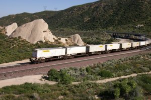
BNSF EB going uphill on BNSF tracks - 2174 | in the foreground is the UPT - 2175 | intermodal trains are everyday's business - 2176 |
2177 | 2178 | 2179 |
2180 | 1st DPU 7213 = GE ES44DC built 2009 - 2181 | 2182 |
2nd DPU 7564 = GE ES44DC built 2007 - 2183 | 2184 | end of BNSF EB train - 2185 |
After the BNSF EB train above, we went to Sullivans Curve. These photos can be seen on this page: click here. So, after our successful mission at Sullivans Curve, we stopped again here to catch our next train, a UP NB on UPT coming from Colton and heading for Palmdale. | ||
UP NB on UPT (Colton-Palmdale Cutoff) - 2254 | 2255 | 2256 |
UP 5365 = GE C45ACCTE built 2005 - 2257 | 3rd unit 8381 = EMD SD70ACe built 2005 - 2258 | 4th unit 8386 = EMD SD70ACe built 2005 - 2259 |
there is a BNSF WB behind the UP train - 2260 | 2261 | last car of UP NB and BNSF WB at right - 2262 |
BNSF WB - 2263 | end of UP NB train - 2264 | 2265 |
2266 | 2267 | 2268 |
2269 | 2270 | left: old brige, right new 3MT bridge - 2271 |
The overlook of the UPT (Union Pacifc Track) is easy to reach using Hwy 138 from I-15 intersection. Drive Hwy 138 West over BNSF MT-3 and BNSF MT-1/MT-2 and under UPT, just after the underpass make a left turn into Lone Pine Canyon Road uphill and turn again left (dirt road) which runs parallel to the UPT. It is the service road for UP but also a US Forest Service Road (USFS 2N89). If we continue following this road, it will lead us to Sullivans Curve. Best time of the day is late afternoon/early evening as we have the sun in the back. | ||
in the foreground is the UPT - 2272 | How to reach this location: | last photo of this BNSF WB tarin - 2273 |
Part 3 - Sunday, May 30, 2010
The next day (Sunday, May 30) after visitting the Silverwood area (can be seen on this page - click here), we went with Christa & Beat again to the Mormon Rocks in the late afternoon. As we reached the Mormon Rocks next to BNSF MT-1 and MT-2, the first BNSF WB was already coming around the curve from Davis Ranch Road. Therefore, we had to take pictures from the "wrong" side (w/o sunlight). | ||
BNSF WB coming from DRR - 2537 | the first loco is at MP 61.4 X - 2538 | Going under Hwy 138 bridge - 2539 |
our ladies go for a walk - 2540 | railfanning and outdoors activities - 2541 | in the meantime, we moved to the sunny side - 2542 |
After the BNSF WB passed, we went to the other side and were walking uphill toward the Mormon Rocks for a good view. Soon, a UP WB was coming round the curve on BNSF MT-2. | ||
Christa & Melinda take care of our homebase 2543 | UP WB coming downhill on MT-2 . . . - 2544 | . . . with 3 diesel locos - 2545 |
UP 8591 = EMD SD70ACe built 2007 - 2546 | 2nd unit 3940 = EMD SD70M built 2003 - 2547 | 3rd unit 4492 = EMD SD70M built 2001 - 2548 |
after passing the Cajon Creek . . . - 2549 | . . . the train is going under Highway 138 - 2550 | 2551 |
2552 | 2553 | 2554 |
many intermodal trains have . . . - 2555 | . . double stack container cars in front and . . - 2556 | . . TOFC (Trailer on Flat Car) at the rear - 2557 |
end of UP WB intermodel train - 2558 | Our patient ladies (Melinda & Christa) - 2559 | BNSF bridge over Cajon Creek - 2560 |
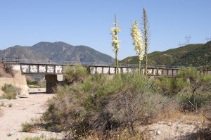
Blooming Yucca - 2561 | unique sandstone rock formation - 2562 | BNSF WB on MT-2 coming round the curve - 2563 |
one more train for our cameras - 2564 | 2565 | BNSF 7710 = GE ES44DC built 2005 - 2566 |
BNSF 7714 = GE ES44DC built 2005 - 2567 | BNSF 7764 = GE ES44DC built 2005 - 2568 | BNSF 7715 = GE ES44DC built 2005 - 2569 |
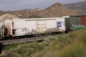
heavy graffiti on this loco - 2570 | 2571 | 63' Reefer w/plenty graffiti - 2572 |
2573 | old "The Rock" covered hopper - 2574 | 2575 |
2576 | 2577 | 2578 |
2579 | 2580 | last photo of this BNSF WB train - 2581 |
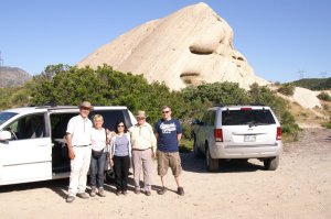
sign on electrical box at MP 61.4 X - 2582 | international railfans from Europe . . . - 2583 | . . . and one American - 2584 |
Photo 2582: Our current position is MP 61.4 X.
This sign was mounted on the electrical box to the left of our cars. Yes,
there was an A/C keeping the temperature inside the box in limits. Photo
2583: Railfans from all over the world (from left to right): Beat & Christa
Wuest (Switzerland), Gentleman from Texas (USA), Melinda Meer (Switzerland)
and another Gentleman (Ireland). Werner joined the second photo. Request: If these two Gentlemen will see their photos, please send me an email as I would like to mention your names. |
Part 4 - Friday, June 4, 2010
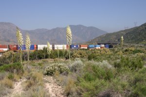
June 4: Before coming again to the Mormon Rock Area, we took lots of photos at WSI (West Summit Island/Silverwood) - take a look: click here. Photo 4366 was taken from the UPT looking toward the Cajon Creek bridge of BNSF (MT-1 and MT-2). Photo 4367 shows a BNSF EB coming thru the cut (out of Sullivans Curve) in the distance. On photo 4369 the first loco can be seen under the Highway 138 bridge. I am now standing between the UPT and the BNSF tracks in the middle of blooming Yuccas. As usual, I am going to show plenty photos of the same train (almost like a movie). Well, it is a lucky day because there was also a UP EB train coming uphill at the same time. So, we had a parallel race of BNSF and UP toward Summit. | ||
this is the UPT in front (which I had to cross) - 4366 | BNSF EB coming from Sullivans Curve - 4367 | Headlights of first BNSF loco under Hwy 138 - 4369 |
I am now standing between the UPT . . . - 4370 | . . . and the BNSF tracks on the North . . . - 4371 | . . . side of Highway 138 - 4372 |
how wonderful the desert vegetation . . . - 4373 | . . . can be with these blooming Yuccas - 4374 | 1st unit 7840 = GE ES44DC built 2010 - 4375 |
2nd unit 7210 = GE ES44DC built 2009 - 4376 | 3rd unit 5261 = GE C44-9W built 2001 - 4377 | 4th unit 7484 = GE ES44DC built 2008 - 4378 |
4379 | 4380 | under the bridge is the front of a UP loco - 4381 |
yes, we do have another EB train - 4382 | the parallel race up the hill on BNSF tracks - 4383 | there is a BNSF loco in between - 4384 |
4385 | 4386 | 2nd unit UP 4873 = EMD SD70M built 2002 - 4387 |
1st unit UP 7602 = GE C45ACCTE built 2007 - 4388 | 3rd unit BNSF 9506 = EMD SD70MAC 1994 - 4389 | 4th unit UP 7125 = GE C44AC built 1998 - 4390 |
4391 | 4392 | 4393 |
4394 | 4395 | 4396 |
after the double stack cars . . . - 4397 | . . . are some auto carriers - 4398 | 4399 |
4400 | 4401 | 4402 |
after the auto racks are more double stacks - 4403 | nice idea to copy this consist for modelling - 4404 | last cars of BNSF EB train (behind UP train) - 4405 |
4406 | here comes the rear end helper (DPU) - 4407 | this UP train will pass Barstow and at . . . - 4408 |
. . Daggett it will be going back to UP tracks - 4409 | DPU UP 7877 = GE C45ACCTE built 2008 - 4410 | end of UP EB train - 4411 |
It is quiet again as both EB trains are gone. Time to take some more photos of the famous rock formations from diff. angles. As I was walking back to our car, which was parked above the UPT, I caught the view of the rocks facing toward East and North. | ||
looking North: left of the UPT are these rocks - 4416 | UPT is at left and BNSF tracks at right - 4419 | looking East: UPT w/Cajon Creek bridge - 4414 |
We went back to the UPT on the other side of Highway 138. It is the service road for UP but also a US Forest Service Road (USFS 2N89). Soon after the UP (ex. SP) bridge over Hwy 138, the long siding starts (it ends just after Sullivans Curve). Photo 4420: There is also a set out track with diff. size tracks. These are connected with a special rail joiner (similar to code 100 and code 83 tracks in HO scale). Photo 4421: Here comes a UP NB train from Sullivans Curve. | ||
UP rail transition on spur - 4420 | UP NB coming from Sullivans Curve - 4421 | 4422 |
4423 | locos pass end of UP siding - 4424 | 4426 |
4427 | 4428 | UP 8486 = EMD SD70ACe built 2006 - 4429 |
4430 | rolling over Highway 138 - 4431 | 2nd unit 4918 = EMD SD70M built 2002 - 4432 |
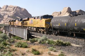
3rd unit 7725 = GE C45ACCTE 2007 - 4433 | a mixed freight is always interesting to see - 4434 | above the gondola is a BNSF WB downhill - 4435 |
too bad, we are not on a higher elevation - 4436 | so, as we cannot really see the WB train . . - 4437 | . . . we concentrate on our UP NB train. . . - 4438 |
. . . as there are lots of diff. cars and most . . - 4439 | . . . cars are full of graffiti - just enjoy - 4440 | how about adding some graffity . . . - 4441 |
. . . on the model cars? - 4442 | there is an endless variety - 4443 | 4444 |
4445 | 4446 | 4447 |
4448 | because of a flat car, we can see the WB - 4449 | 4450 |
4451 | Procor becomes a Doctor ! ! - 4452 | I wonder how much paint is used for it ? - 4453 |
4454 | 4455 | 4456 |
see thru the empty lumber car to Hwy 138 . . - 4457 | . . . and to the BNSF WB train below - 4458 | 4459 |
4460 | DPU's of BNSF train can be seen - 4461 | 4462 |
4463 | 4465 | 4466 |
UP 8428 = EMD SD70ACe built 2006 - 4467 | DPU's of both trains look like a meet - 4468 | BNSF DPU's and Hwy 138 - 4469 |
end of UP NB train - 4470 | 4472 | end of BNSF WB train - 4473 |
Part 5 - Saturday, June 5, 2010
After taking photos of Sullivans Curve, we stopped again near Highway 138 along the UPT. This was our last visit to this location before we had to fly back to Switzerland the other day. | ||
BNSF WB on MT-2 - 4831 | the engines are reaching Hwy 138 . . - 4832 | . . . and passing underneath - 4833 |
BNSF 7444 = GE ES44DC built 2008 - 4834 | 2nd unit 7647 = GE ES44DC built 2005 - 4835 | 4836 |
I am now standing closer to the BNSF . . - 4837 | . . tracks (MT-1 and MT-2), actually . . - 4838 | . . on the other side of the UPT - 4839 |
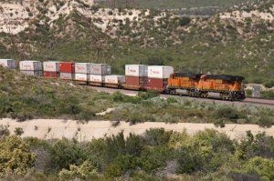
4840 | no question, if I can see some Werner . . . - 4841 | . . . Enterprises Trailers on flat cars, . . . - 4842 |
. . . I am always happy - 4843 | 4844 | 4845 |
4846 | 4847 | 4848 |
4849 | 4850 | 4851 |
this is the UPT w/siding - 4852 | end of train - 4853 | heading for Sullivans Curve - 4854 |
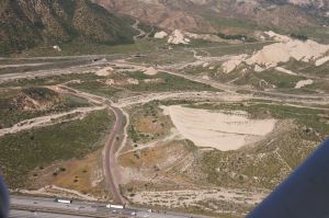
At the end, we went to the North side of Highway 138 and took some pictures of this area from above. | ||
Interstate 15 in the middle - 4855 | UPT w/Cajon Creek bridge in front of the rocks 4856 | BNSF tracks w/filled pit of 3MT construction - 4857 |
overview: Hwy 138, BNSF tracks, I-15 - 4860 | close up of Mormon Rocks along . . . - 4861 | . . . Highway 138, North of the UP track - 4862 |
A BNSF WB coming down on MT-3 - 4863 | MT-3 has a 3 % grade and is usually used . . - 4864 | . . for WB (downhill) trains - 4865 |
constant traffic on I-15 while this . . . - 4866 | . . . intermodal train keeps on rolling - 4867 | BNSF WB and Werner Ent. Truck on I-15 - 4870 |
Well, the show is over and it is time to go back to the motel, have dinner and make final packing for the flight on Monday, June 6, 2010. No question, we had a fantastic time, made more than 3000 photos and met great friends. Hopefully, it was not the last journey to Cajon Pass ! ! |
This map shows the
location of the Mormon Rocks (Pine Lodge Area) with I-15 and Hwy 138. Captions
by Gary G. Gray.
Here you find some maps and more infos about Cajon Pass:
8 different and detailed Maps of Cajon Pass with
captions (Mile Posts and Location) by Gary G. Gray - click
here (Very helpful to find the locations between Summit and Blue Cut incl. Hill 582) |
New 8/11: Maps "How to find" Hill 582, Sullivan's Curve, Noisy Point by Gary G. Gray - click here |
Accurate Map of Cajon Pass with 3rd Main Track by Michael Amrine - click here |
Simple Maps about Cajon Pass: click here |
Railfan Map of Cajon Pass by Joe Perry: http://www.chasingsteel.com/storage/RailfanMapofCajon%20Pass.pdf |
Map of Cajon Area (Inland Empire): http://www.visitcalifornia.de/media/pages/getting_around/maps/INLAND-EMPIRE.pdf |
Cajon Pass Map by Wikimapia (easy to enlarge every location): http://wikimapia.org/#lat=34.3223857&lon=-117.4707127&z=14&l=0&m=s&v=9 |
Here are photos of the 2 tunnels before construction started: click here |
Did you see page 1/9 ? - click here - Aerial Photos | Did you see page 2/9 ? - click here - Hill 582 Part 1 |
Did you see page 3/9 ? - click here - Hill 582 Part 2 | Did you see page 4/9 ? - click here - Hill 582 Part 3 |
Did you see page 5/9 ? - click here - Summit/Silverwood | Did you see page 6/9 ? - click here - Alray Tunnel Area |
Did you see page 7/9 ? - click here - Sullivans Curve | Did you see page 8/9 ? - click here - Mormon Rocks |
Did you see page 9/9 ? - click here - along Cajon Blvd. | Go back to my Cajon 2010 Photo Main Page - click here |
Go back to Cajon Pass Main Page - click here