| TRAINMASTER
BY WERNER MEER US-RAILROAD-SHOP KILCHBERG HOCHWEIDSTRASSE 3 CH-8802 KILCHBERG (ZÜRICH) SWITZERLAND (founded 1977) PHONE *41-44-715-3666, FAX *41-44-715-3660, E-MAIL trainmaster@bluewin.ch Go back to our Website - click here |
updated: October 14, 2016 / March 26, 2017
| Cajon Pass - Maps and How to find |
by Gary G. Gray
|
Not everybody is familiar with Cajon Pass and does not know, how to find some of
these locations. We solved this problem and on these pages, you can find lots of Maps with captions by Gary G. Gray. We also have special Maps "How to find" a particular location? |
 |
Cajon Pass 8 different and detailed Maps with captions (Mile Posts and Location) by Gary G. Gray click here Updated: 8/02/2011 |
 |
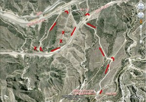 |
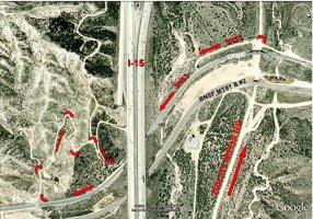
Cajon Pass How to find Hill 582? Map showing directions by Gary G. Gray click here Updated: 8/02/2011 |
 |
 |
Cajon Pass How to find Sullivan's Curve? Map showing directions by Gary G. Gray click here Updated: 8/02/2011 |
 |
 |
Cajon Pass How to find Noisy Point? Map showing directions by Gary G. Gray click here Updated: 4/03/2016 |
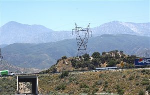 |
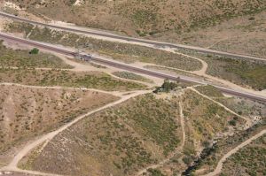
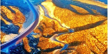
Below are photos taken from the air on
June 2, 2010. Even there was not a single train in the Pass during our flight,
it
still gives an idea about the different locations. We also recommend to see
our 8 diff. maps by Gary Gray (see below).
|
Cajon Pass Aerial Photos 2010 by Werner Meer June 2, 2010 Updated: 7/08/2010 |
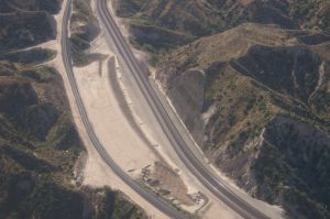 |
| WM 6/02/10 Hill 582, BNSF MT-2/-1, UPT - 4033 | See all 150 photos - click here | WM 6/02/10 Tunnel 1 shotcrete retaining wall - 4082 |
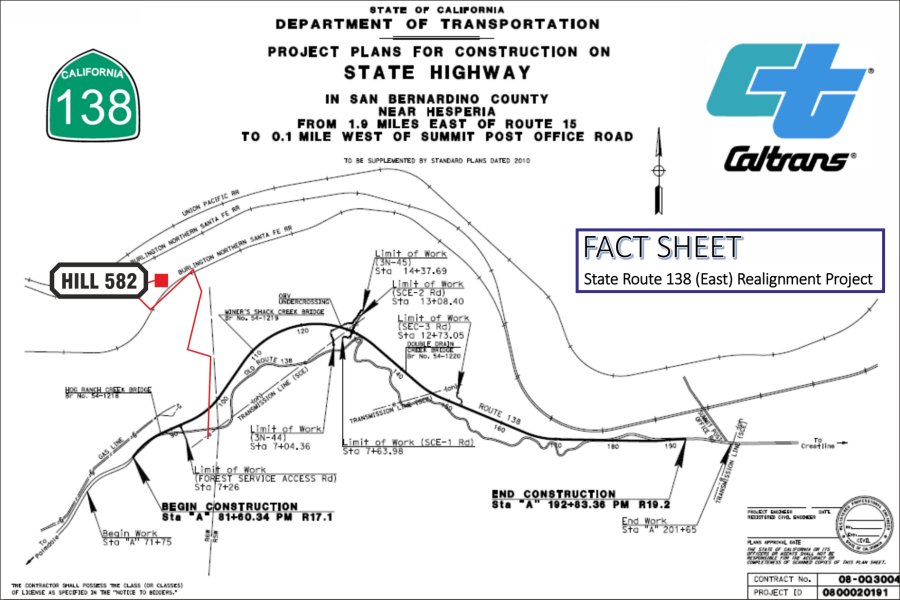
| March 26, 2017: Highway 138 (East) Realignment Project is now under way. | |
|
For all who are familiar with Hwy 138 while
visitting Cajon Pass, are aware of the old two lane and curvy Highway 138
coming from exit # 131 (I-15) and going to Summit. Several years ago, Hwy
138 has been widened after the exit toward Summit for the first 1.9 mls. But
from that point up to Summit, it is a curvy up and down slow speed
(mountain) road. Three bridges and one undercrossing will be built. (Hog Ranch Creek Bridge, Vjner's Shack Creek Bridge, OHV Undercrossing, Double Drajn Cheek Bridge) |
|
| See our detailed documentation with lots of photos from this project - click here | |
 |
|
| Map copyright by Caltrans and RUS - 6214 | |
|
more infos:
http://www.dot.ca.gov/dist8/documents/sr138/SR-138-EAST-ALIGNMENT-FACT-SHEET-070716.pdf
more detailed infos with different maps: http://www.spl.usace.army.mil/Portals/17/docs/publicnotices/SR138_realignment.pdf |
|
 Hwy 138 looking toward Summit. Photo Courtesy (copyright): San Bernardino County Sherrif's Department 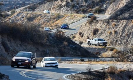 Hwy 138 is famous for the mountain style road with tight curves, up and down with grade up to 15 %. Every railfan knows this road very well while hanging around Cajon Pass. Photo copyright: The Daily Press, Victorville, CA |
 close up of Summit w/BNSF tracks. Photo Courtesy (copyright): San Bernardino County Sherrif's Department  |
|
all photos are copyright by the original
photographer and as mentioned with each picture. |
This curvy and hilly road will be history in
2018. Photo copyright: The Daily Press, Victorville, CA |
Here you find some other maps and more infos about Cajon Pass and the former Tunnels:
| New 7/11: Fold out map of Cajon Pass in August 2011 issue of TRAINS magazine - click here |
| Accurate Map of Cajon Pass with 3rd Main Track by Michael Amrine - click here |
| Cajon Pass Map by Wikimapia (easy to enlarge every location): http://wikimapia.org/#lat=34.3223857&lon=-117.4707127&z=14&l=0&m=s&v=9 |
| Railfan Map of Cajon Pass by Joe Perry: http://www.chasingsteel.com/storage/RailfanMapofCajon%20Pass.pdf |
| Map of Cajon Area (Inland Empire): http://www.visitcalifornia.de/media/pages/getting_around/maps/INLAND-EMPIRE.pdf |
| Here are photos of the 2 tunnels before construction started: click here |
Go back to Cajon Pass Main Page - click here