TRAINMASTER
BY WERNER MEER US-RAILROAD-SHOP KILCHBERG
HOCHWEIDSTRASSE 3 CH-8802
KILCHBERG (Z‹RICH) SWITZERLAND (founded 1977)
PHONE *41-44-715-3666, FAX
*41-44-715-3660, E-MAIL trainmaster@bluewin.ch
Go back to our Website - click
here |
added: August 2, 2011
/ updated: October 14, 2016 / updated: March 26, 2017
| Cajon Pass Maps with MP (Mile
Posts) and Location Names |
As the 3MT (3rd Main Track) by BNSF is finished since November
2008, we (Railfans) need to know the different locations.
A big thank you to Gary G. Gray, who made the captions. In addition, below each
Map, we put some aerial photos of the same area to give more infos about the
locations (aerial photos by Werner Meer and captions by Gary Gray).
We are having a great photo documentation of the 3MT Contruction by BNSF with
more than 900 photos.
Take a look, you will be impressed (links are below the maps).
The maps shown start from East to West at Summit MP 55.9
down below Blue Cut at MP 65.5. |
|
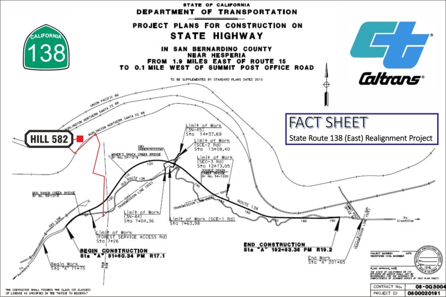
March 26, 2017: Highway 138
(East) Realignment Project is now under way. |
For all who are familiar with Hwy 138 while
visitting Cajon Pass, are aware of the old two lane and curvy Highway 138
coming from exit # 131 (I-15) and going to Summit. Several years ago, Hwy
138 has been widened after the exit toward Summit for the first 1.9 mls. But
from that point up to Summit, it is a curvy up and down slow speed
(mountain) road. Three bridges and one undercrossing will be built.
(Hog Ranch Creek Bridge, Vjner's Shack Creek Bridge, OHV Undercrossing,
Double Drajn Cheek Bridge) |
|
See our detailed documentation
with lots of photos from this project - click
here |
 |
|
Map copyright by Caltrans and RUS -
6214 |
more infos:
http://www.dot.ca.gov/dist8/documents/sr138/SR-138-EAST-ALIGNMENT-FACT-SHEET-070716.pdf
more detailed infos with different maps:
http://www.spl.usace.army.mil/Portals/17/docs/publicnotices/SR138_realignment.pdf |
New 8/11: We have detailed maps with captions
"How to find" Hill 582 and Sullivan's Curve between the other maps.
Go pack to our Cajon Pass Maps and "How to find" Page - click
here
|
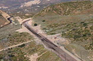
Map 1: BNSF Summit MP 55.9, WSI MP 56.7X,
Silverwood MP 57.2X
|
 |
Elevation of BNSF Summit is 3777 feet
(1151 m)
(I-15 Summit is 4190 feet - 1280 m)
|
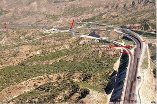
For bigger size
aerial photos with captions please click on the 4-digit number. These 3
photos show locations for Map 1. |
 |
 |
 |
|
Summit MP55.9
195-1 |
West Summit
Island MP 56.7 195-2 |
Silverwood MP
57.2 195-3 |
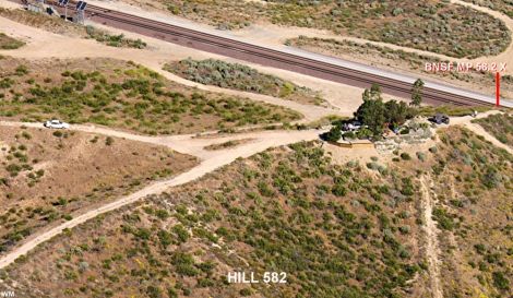
| Map 2: BNSF MP
57.2X, Hill 582 MP 58.2X
|
 |
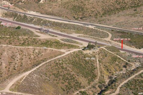
| For
bigger size aerial photos with captions please click on the 4-digit number.
Both photos show locations for Map 2. |
 |
 |
|
Hill
582 MP 58.2X overview 196-1 |
Hill
582 MP 58.2X close-up 196-2 |
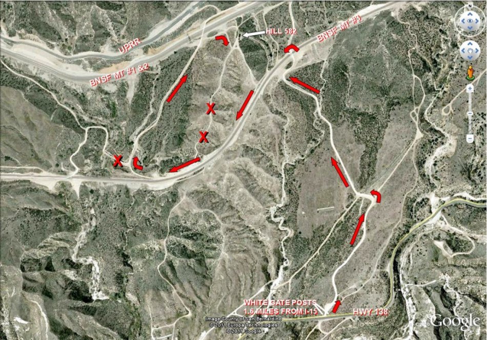
Below is a Google map showing directions to Hill 582.
Here is an edited Google map showing the most common route used to visit
Cajon Hill 582. Yearly, hundreds of railfans visit the Hill without
incident, however we feel it necessary to enclose several "cautions".
Hwy 138 is a very narrow, winding and high-speed road. The turn onto the
Hill 582 road can be dangerous. The turn-off is 1.6 miles from I-15. The
road crossing of BNSF MT-3 deserves considerable caution.
The dirt roads leading to Hill 582 (1.3 miles) are NOT maintained and are
very rough. We see numerous automobiles on the Hill but a vehicle with some
clearance is recommended. On the map, the roads with a large red
X should NOT be used.
Snakes and Bee Hives are common throughout Cajon. Rattle Snakes are seen
frequently. Children and pets should be closely monitored when visiting all
areas of Cajon Pass. Common sense rules of exploring any desert should be
adhered to.
So far, the USFS and BNSF have "tolerated" our presence on Hill 582. Please
respect the land and stay away from the tracks.
The Hill 582 Bunch (GGG & DET) 7/27/11 |
 |
|
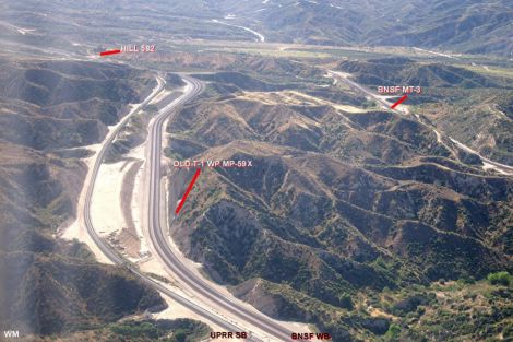
Map 3: Hill 582, Tunnel 1 MP 58.9X, Tunnel 2 MP 59.2X
(both
tunnels are gone), Baldy Mesa Rd. MP 59.5X, CP Walker MP 60.6X
|
 |
| For
bigger size aerial photos with captions please click on the 4-digit number.
Both photos show locations for Map 3. |
 |
 |
|
Alray
- Baldy Mesa Road MP 59.5X (former Tunnels) 197-1 |
Former
Tunnel 1 (all 4 tracks visible) 197-2 |
|
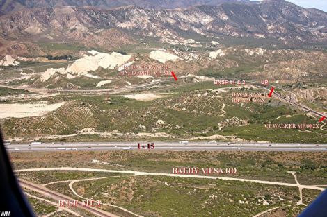
Map 4: CP Walker MP 60.2X, Davis Ranch Rd. MP 60.6X,
Mormon Rocks, Pine Lodge MP 62.2X
|
 |
| For
bigger size aerial photos with captions please click on the 4-digit number.
Both photos show locations for Map 4 and Map 5. |
 |
 |
|
Mormon
Rocks, Pinelodge, CP Walker (I-15) 198-1 |
Mormon
Rocks, HWY 138 198-2 |
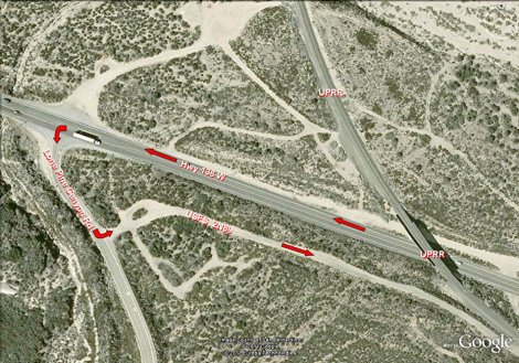
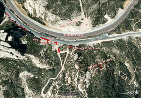
Below is a Google map showing directions to Sullivan's
Curve.
Here are three edited Google maps showing the most common route used to
visit Sullivanís Curve. Yearly, hundreds of railfans visit the the area
without incident, however we feel it necessary to enclose several
"cautions".
Hwy 138 is a very narrow, winding and high-speed road. The turn onto the
Lone Pine Canyon Road and then onto 2N89 deserve considerable caution.
The gravel road leading to Sullivanís shares space with the UPRR and can be
very rough and narrow. We see numerous automobiles on the curve but a
vehicle with some clearance is recommended.
Snakes and Bee Hives are common throughout Cajon. Rattle Snakes are seen
frequently. Children and pets should be closely monitored when visiting all
areas of Cajon Pass. Common sense rules of exploring any desert should be
adhered to.
Please respect the land and stay away from
the tracks.
The Hill 582 Bunch (GGG & DET) 8/02/11 |
 |
| For
bigger size map photos with captions please click on the 4-digit number.
Both maps show details for the Overview Map above. |
 |
 |
|
Lone Pine Canyon Road Detail -
1183 |
Sullivan's Curve Overlook Detail -
1184 |
|
Map 5: HWY 138, Pine Lodge MP 62.2X, Sullivan's Curve
MP 63X, Bridge MP64.1X, Cajon Station (Junction) MP 62.8
|
 |
| For
bigger size aerial photos with captions please click on the 4-digit number.
Both photos show locations for Map 5. |
 |
 |
|
Sullivan's
Curve MP 63X 199-1 |
Cajon
Station MP 62.8 199-2 |
|
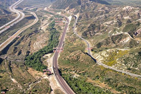
Map 6: Sullivan's Curve MP 63X, Cajon Station
(Junction)
MP 62.8, Bridge MP 63.4
|
 |
| For
bigger size aerial photos with captions please click on the 4-digit number.
Both photos show locations for Map 6. |
 |
 |
|
Cajon
Station (Junction), I-15 Cleghorn Exit to Route 66 200-1 |
Looking South - below Cajon Station
200-2 |
|
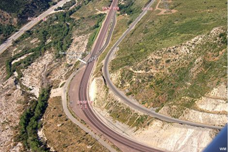
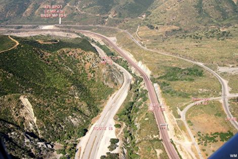
Map 7: Nasty Knoll MP 64.3, SWC
(Swarthout Canyon Road X-ing) MP 64.4, Blue Cut MP 65 |
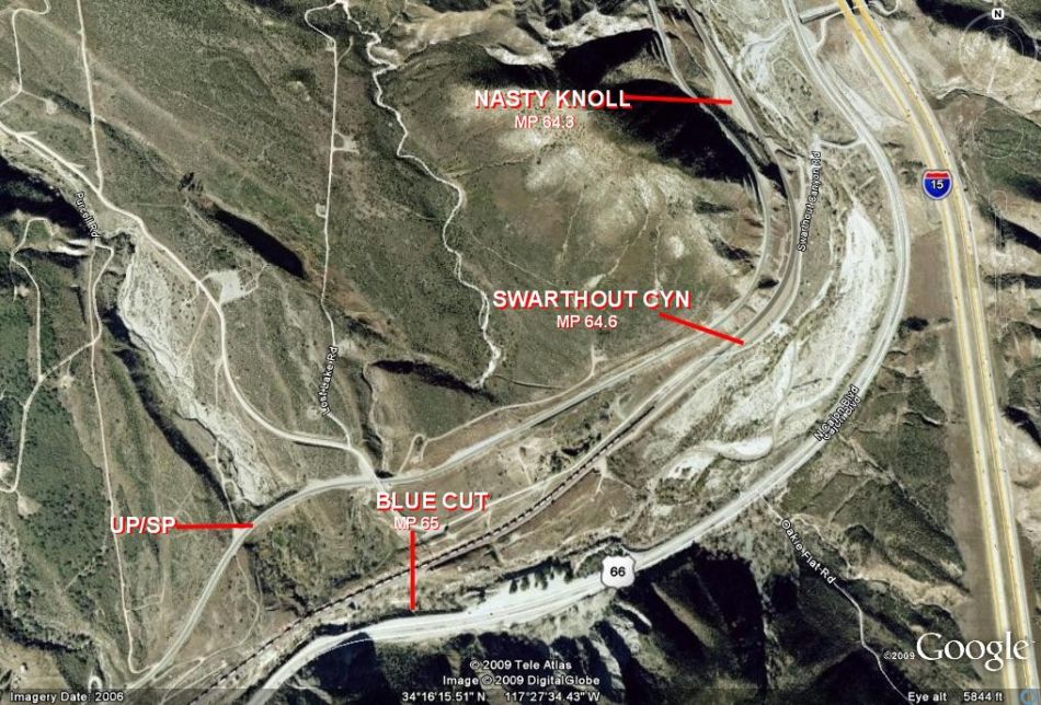 |
| For
bigger size aerial photos with captions please click on the 4-digit number.
Both photos show locations for Map 7 and Map 8. |
 |
 |
|
Swarthout
Canyon Road Crossing MP 64.6 (SWC)
201-1 |
below
SWC, Blue
Cut MP 65, lower canyon 201-2 |
|
Map 8: SWC MP 64.6, Blue Cut MP 65, Keenbrook Road MP
65.5
|
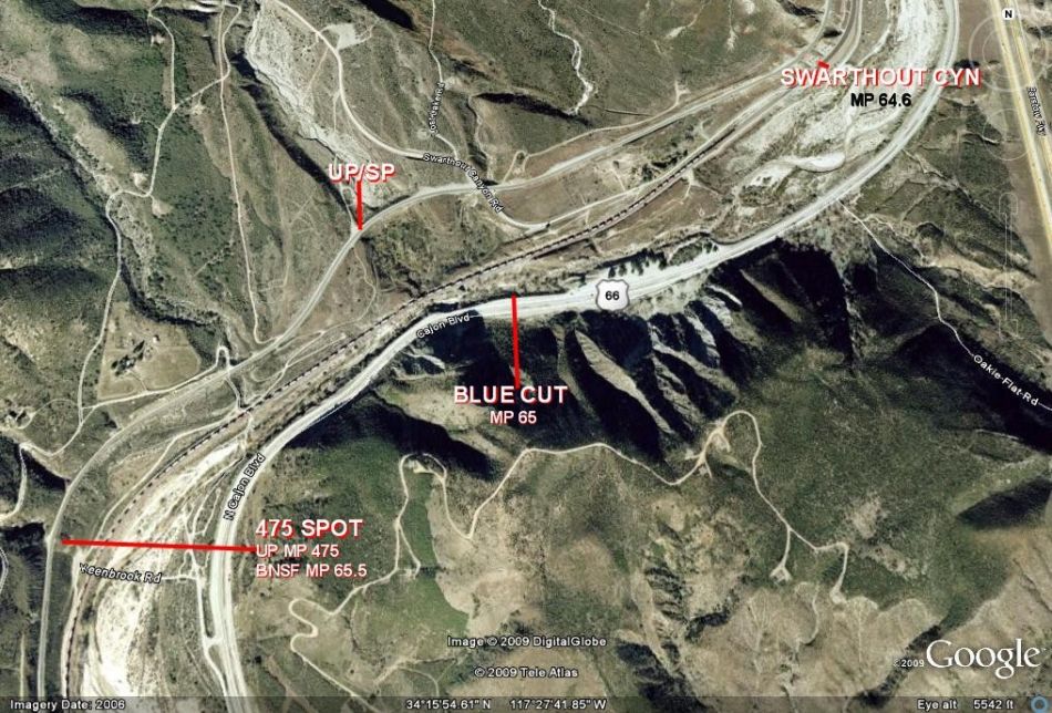 |
Map 1 - Map 8 copyright by Google Earth
and Gary Gray / Aerial photos copyright by Werner Meer and Gary Gray
|
MILEPOSTS on Google Maps and
Aerial Photos |
|
The original track through Cajon was completed in 1885 with a
ruling grade of 3%. The MilePosts were numbered from East to West starting at
Barstow.
In 1913, a two mile longer second main track was completed with a ruling
grade of 2.2%. The NEW 1913 main became the NORTH (#1) track while the original
track became the SOUTH (#2) track. Since there was a two mile difference in the
tracks between West Summit Island and Cajon Jct, the new MilePosts for the North
track were given an "X" to denote a separate track. When the #1 and #2 tracks
returned to parallel running at Cajon Jct, the newer North #1 track simply
"lost" two miles and became MilePost equal to the original track.
|
| Barstow -
Summit |
Summit - Cajon
Station (2,2 %) |
Cajon Station
- San Bernardino |
| MP |
Location |
MP |
Location |
MP |
Location |
| 0.0 |
Barstow |
55.9 |
Summit |
62.8 |
Cajon Station |
| 6.7 |
Lenwood |
56.7X |
West Summit
Island |
63.4 |
Curved Bridge |
| 13.6 |
Hodge |
57.2X |
Silverwood -
Bridge USFS 3N45 |
64.4 |
Swarthout Canyon
Road X-ing |
| 21.1 |
Helendale |
58.2X |
Hill 582 |
65.0 |
Blue Cut |
| 31.5 |
Oro Grande |
58.9X |
former Tunnel 1
(Alray) |
67.3 |
Old Keenbrook |
| 34.6 |
East Victorville |
59.2X |
former Tunnel 2
(Alray) |
69.4 |
Keenbrook |
| 36.7 |
Victorville |
59.5X |
Bridge over Baldy
Mesa Road |
71.0 |
Devore |
| 38.0 |
Frost |
60.2X |
CP Walker |
73.9 |
Verdemont |
| 39.1 |
Flyover |
60.6X |
Davis Ranch Road
X-ing |
75.0 |
Ono |
| 41.1 |
Thorn |
62.2X |
Pine Lodge -
Mormon Rocks |
79.9 |
Baseline |
| 45.1 |
Hesperia |
63.0X |
Sullivan's Curve |
80.6 |
7th Street |
| 50.1 |
Lugo |
64.1X |
Bridge over Cajon
Creek |
81.4 |
San Bernardino |
| 52.8 |
Martinez |
62.8 |
Cajon Station |
- |
- |
| 55.9 |
Summit |
- |
- |
- |
- |
With completion of construction of the new Third Main track,
the "MILES" on MilePosts on the #1 and #2 tracks were lengthened to
about 1.15 miles each to coincide (at Cajon Jct) with the 1913 track Mile Posts.
In other words, for railroad purposes the distance between Summit and Cajon is
now considered to be the same for all three tracks, even though the actual
distance is 1.15 miles between mile posts on tracks #1 and #2.
In the following photographic documentation of the BNSF Cajon
Pass Third Main construction, all appropriate Mileposts on the #1 and #2 tracks
between Summit and Cajon will use the OLD Mile Post numbering system and
therefore will be followed by an "X". |
Below are links to the BNSF 3rd Main Track Project
Did you see page 1? - please click
here
Did you see page 2? - please click here
Did you see page 3? - please click here
Did you see page 4? - please click here
Did you see page 5? - please click here
Did you see page 6? - please click here
Did you see page 7? - please click here
Did you see page 8? - please click here
Did you see page 9? - please click here
Go back to 3rd MT Main Page - click here
Go back to Cajon Pass Main Page - click here
Map of BNSF 3MT from Summit to Devore by Michael Amrine - click
here
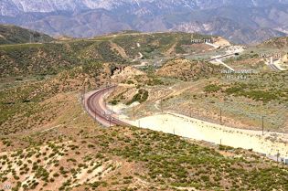
The
other side of Cajon - from Summit to the Mojave River Bridges in East
Victorville
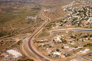
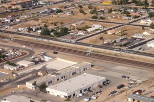
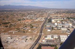
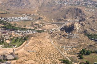
On these 9 aerial photos we move
Eastwards. Once again, aerials by Werner Meer and captions by Gary Gray. (click
on the number to enlarge) |
 |
 |
 |
| BNSF Summit MP
55.9 195-1 |
Martinez - Summit
Curve 230-2 |
Martinez MP
52.8 230-3 |
 |
 |
 |
| California
Aqueduct - Lugo MP 50.1 230-4 |
Hesperia
230-5 |
Hesperia/Victorville - Bear Valley Road
230-6 |
 |
 |
 |
|
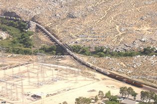
Flyover MP 39.1 -
Frost MP 38 - Narrows 230-7 |
Victorville -
Mojave River Upper Narrows
230-8 |
East Victorville,
Mojave River Bridges MP 34.1 230-9 |
Go pack to our Cajon Pass Maps and "How to find" Page - click
here
Go back to Cajon Pass Main Page - click
here


