| TRAINMASTER
BY WERNER MEER US-RAILROAD-SHOP KILCHBERG HOCHWEIDSTRASSE 3 CH-8802 KILCHBERG (ZÜRICH) SWITZERLAND (founded 1977) PHONE *41-44-715-3666, FAX *41-44-715-3660, E-MAIL trainmaster@bluewin.ch Go back to our Website - click here |
updated: August 2, 2011
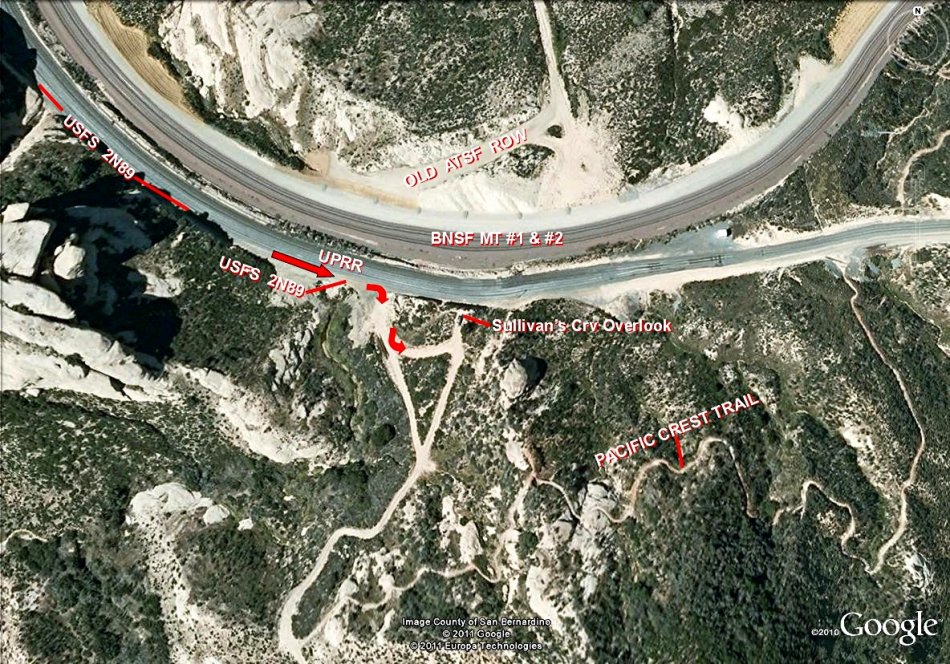
| Cajon Pass - Map of Sullivan's Curve |
| by Gary G. Gray |
|
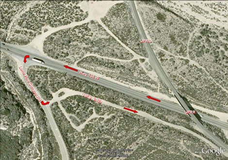
Below is a Google map showing directions to Sullivan's
Curve. Here are three edited Google maps showing the most common route used to visit Sullivan’s Curve. Yearly, hundreds of railfans visit the area without incident, however we feel it necessary to enclose several "cautions". Hwy 138 is a very narrow, winding and high-speed road. The turn onto the Lone Pine Canyon Road and then onto 2N89 deserve considerable caution. The gravel road leading to Sullivan’s shares space with the UPRR and can be very rough and narrow. We see numerous automobiles on the curve but a vehicle with some clearance is recommended. Snakes and Bee Hives are common throughout Cajon. Rattle Snakes are seen frequently. Children and pets should be closely monitored when visiting all areas of Cajon Pass. Common sense rules of exploring any desert should be adhered to. Please respect the land and stay away from the tracks. The Hill 582 Bunch (GGG & DET) 8/02/11 |
 |
| For bigger size map photos with captions please click on the 4-digit number. Both maps show details for the Overview Map above. | |
 |
 |
| Lone Pine Canyon Road Detail - 1183 | Sullivan's Curve Overlook Detail - 1184 |
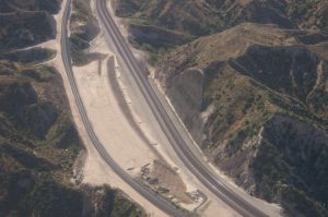
Below are photos taken from the air on
June 2, 2010. Even there was not a single train in the Pass during our flight,
it
still gives an idea about the different locations. We also recommend to see
our 8 diff. maps by Gary Gray (see below).
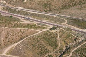 |
Cajon Pass Aerial Photos 2010 by Werner Meer June 2, 2010 Updated: 7/08/2010 |
 |
| WM 6/02/10 Hill 582, BNSF MT-2/-1, UPT - 4033 | See all 150 photos - click here | WM 6/02/10 Tunnel 1 shotcrete retaining wall - 4082 |
Here you find some maps and more infos about Cajon Pass and the former Tunnels:
| 8 different and detailed Maps of Cajon Pass with captions (Mile Posts and Location) by Gary G. Gray - click here |
| Accurate Map of Cajon Pass with 3rd Main Track by Michael Amrine - click here |
| Cajon Pass Map by Wikimapia (easy to enlarge every location): http://wikimapia.org/#lat=34.3223857&lon=-117.4707127&z=14&l=0&m=s&v=9 |
| Railfan Map of Cajon Pass by Joe Perry: http://www.chasingsteel.com/storage/RailfanMapofCajon%20Pass.pdf |
| Map of Cajon Area (Inland Empire): http://www.visitcalifornia.de/media/pages/getting_around/maps/INLAND-EMPIRE.pdf |
| Here are photos of the 2 tunnels before construction started: click here |
Go pack to our Cajon Pass Maps and "How to find" Page - click
here
Go back to Cajon Pass Main Page - click here