| TRAINMASTER
BY WERNER MEER US-RAILROAD-SHOP KILCHBERG HOCHWEIDSTRASSE 3 CH-8802 KILCHBERG (ZÜRICH) SWITZERLAND (founded 1977) PHONE *41-44-715-3666, FAX *41-44-715-3660, E-MAIL trainmaster@bluewin.ch Go back to our Website - click here |
added: August 2, 2011 / updated: April 3, 2016
| Cajon Pass - Map of Noisy Point (I-15) |
| by Gary G. Gray |
|
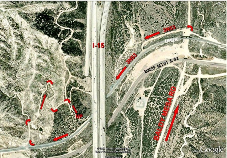
Below is a Google map showing directions to "Noisy
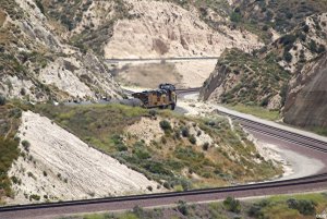
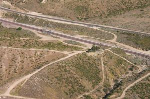
Point" above I-15. Here are two edited Google maps showing the most common route used to visit Noisy Point. From time to time, several railfans visit the area without incident, however we feel it necessary to enclose several "cautions". Noisy Point (NP) is just BNSF RR West of Interstate 15 and above the UP and BNSF CP Walker. From NP, we can see Cajon Summit AND almost to Sullivan's curve - no trains can sneak up upon you. The only drawback is the NOISE from I-15 --- and therefore, the NP name. This map shows how we normally access NP via USFS 3N53. Photos 1138 - 1147 were taken from NP (actually from the powerline tower seen on photo 1137). CAUTION --- USFS 3N53 shares the tunnel under I-15 with the UP/SP tracks. Clearance is tight and so a close check of the signals and a visual check are HIGHLY RECOMMENDED! Access to USFS 3N53 may also be gained via Hwy 138W and Davis Ranch Road. (Gary G. Gray) The Hill 582 Bunch (GGG & DET) 8/02/11 |
 |
| For bigger size map photos with captions please click on the 4-digit number. Both photos show details for the Overview Map above. | |
 |
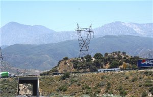 |
| Noisy Point, I-15, Baldy Mesa Road, Alray - 1136 | Noisy Point is just under the Power Line Tower - 1137 |
|
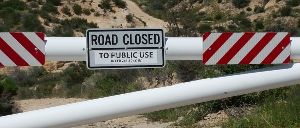
New April 2, 2016: We just learned from Gerard Reminiskey, that the road to
Noisy Point is now gated. Baldy Mesa Road has a similar gate north of the
UPRR Mojave Sub. I think this is an effort to keep people out of the burn
area from last summer's fire. For those who still want to go to Noisy Point for taking pictures have to walk !! Photo copyright by G. Reminiskey |
 |
below are some photos taken from Noisy Point
 |
 |
 |
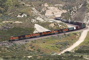
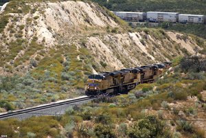
| GGG 6/24/11 BNSF 7724 WB (Tunnel 2) - 1138 | GGG 6/24/11 BNSF WB will pass I-15 - 1139 | GGG 6/24/11 BNSF WB at CP Walker - 1140 |
 |
 |
 |
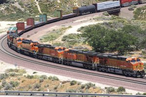
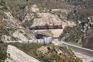
| GGG 6/24/11 UP 5364 EB above CP Walker - 1141 | GGG 6/24/11 Same UP EB Baldy Mesa Road 1142 | GGG 6/24/11 UP EB above T-2 on UPT - 1143 |
 |
 |
 |
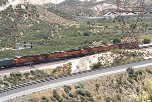
| GGG 6/24/11 UP EB above T-1 - 1144 | GGG 6/24/11 BNSF 6646 EB Baldy Mesa Rd 1146 | GGG 6/24/1 BNSF 7509 EB at Alray - 1147 |
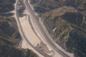
Below are photos taken from the air on
June 2, 2010. Even there was not a single train in the Pass during our flight,
it
still gives an idea about the different locations. We also recommend to see
our 8 diff. maps by Gary Gray (see below).
 |
Cajon Pass Aerial Photos 2010 by Werner Meer June 2, 2010 Updated: 7/08/2010 |
 |
| WM 6/02/10 Hill 582, BNSF MT-2/-1, UPT - 4033 | See all 150 photos - click here | WM 6/02/10 Tunnel 1 shotcrete retaining wall - 4082 |
Here you find some maps and more infos about Cajon Pass and the former Tunnels:
| 8 different and detailed Maps of Cajon Pass with captions (Mile Posts and Location) by Gary G. Gray - click here |
| Accurate Map of Cajon Pass with 3rd Main Track by Michael Amrine - click here |
| Cajon Pass Map by Wikimapia (easy to enlarge every location): http://wikimapia.org/#lat=34.3223857&lon=-117.4707127&z=14&l=0&m=s&v=9 |
| Railfan Map of Cajon Pass by Joe Perry: http://www.chasingsteel.com/storage/RailfanMapofCajon%20Pass.pdf |
| Map of Cajon Area (Inland Empire): http://www.visitcalifornia.de/media/pages/getting_around/maps/INLAND-EMPIRE.pdf |
| Here are photos of the 2 tunnels before construction started: click here |
Go pack to our Cajon Pass Maps and "How to find" Page - click
here
Go back to Cajon Pass Main Page - click here